Fire station nearby Bomberos Voluntarios Malacatán
Guatemala
Fire station nearby Bomberos Voluntarios Malacatán
Bomberos Voluntarios Malacatán
Malacatán Guatemala
contacts phone
:
+502
Latitude:
14.9108396
, Longitude:
-92.0587458
read more
nearest Fire station
7 m
Bomberos Voluntarios
Malacatán
Fire station
read more
7.755 km
Bomberos Municipales, Departamentales
San Pablo
Fire station
read more
29.277 km
16 Cia Bomberos Voluntarios San Marcos San Marcos
San Marcos
Fire station
read more
29.753 km
Bomberos Municipales Departamentales
San Pedro Sacatepequez
Fire station
read more
29.753 km
Bomberos Municipales
San Pedro Sacatepéquez
Fire station
read more
29.997 km
BOMBEROS VOLUNTARIOS 90CIA
San Cristóbal Cucho
Fire station
read more
30.924 km
Bomberos Voluntarios
San Marcos
Fire station
read more
31.047 km
Cruz Roja Delegacion de Coatepeque
Coatepeque
Fire station
read more
31.473 km
Bomberos Municipales Coatepeque
Coatepeque
Fire station
read more
31.478 km
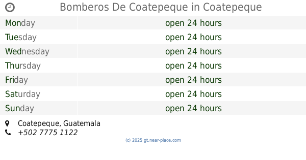
Bomberos De Coatepeque
Coatepeque
Fire station
read more
36.102 km
Bomberos Municipales de Las Delicias
Gwatemala
Fire station
read more
36.102 km
Bomberos Municipales de Las Delicias
Guatemala
Fire station
read more
38.006 km
Bomberos Voluntarios
Comitancillo
Fire station
read more
40.45 km
Bomberos Municipales Génova
Quetzaltenango
Fire station
read more
40.45 km
Bomberos Municipales Génova
Quezaltenango
Fire station
read more
41.6 km
119cia. Bomberos Voluntarios
Colomba
Fire station
read more
43.31 km
Bomberos Municipales Departamentales Concepción Tutuapa
Unnamed Road, Concepción Tutuapa
Fire station
read more
47.808 km
Bomberos Municipales Departamentales San Miguel Siguila
Unnamed Road, San Miguel Sigüilá
Fire station
read more
57.88 km
Compañía de Bomberos Voluntarios
1a Calle, Retalhuleu
Fire station
read more
📑
all categories
Accounting
Administrative area level 1
Administrative area level 2
Airport
Amusement park
Aquarium
Art gallery
Atm
Bakery
Bank
Bar
Beauty salon
Bicycle store
Book store
Bowling alley
Bus station
Cafe
Campground
Car dealer
Car rental
Car repair
Car wash
Casino
Cemetery
Church
City hall
Clothing store
Colloquial area
Convenience store
Courthouse
Dentist
Department store
Doctor
Electrician
Electronics store
Embassy
Establishment
Finance
Fire station
Florist
Food
Funeral home
Furniture store
Gas station
General contractor
Grocery or supermarket
Gym
Hair care
Hardware store
Health
Hindu Temple
Home goods store
Hospital
Insurance agency
Jewelry store
Laundry
Lawyer
Library
Liquor store
Local government office
Locality
Locksmith
Lodging
Meal delivery
Meal takeaway
Mosque
Movie rental
Movie theater
Moving company
Museum
Natural feature
Neighborhood
Night club
Painter
Park
Parking
Pet store
Pharmacy
Physiotherapist
Place of worship
Plumber
Point of interest
Police
Political
Post office
Premise
Real estate agency
Restaurant
Route
Rv park, camping
School
Shoe store
Shopping mall
Spa
Stadium
Storage
Store
Subway station
Supermarket
Synagogue
Taxi stand
Train station
Transit station
Travel agency
University
Veterinary care
Zoo
administrative area level 3
sublocality level 1
↑