School nearby Fe y Alegría Chiantla
Guatemala
School nearby Fe y Alegría Chiantla
Fe y Alegría Chiantla
Unnamed Road Guatemala
contacts phone
:
+502
Latitude:
15.3627797
, Longitude:
-91.4689959
read more
nearest School
793 m
Escuela De San Bartolo
Chiantla
School
read more
1.127 km
EORM Cantón Los Chulubes
Unnamed Road
School
read more
1.418 km
Sagrada Familia
Chiantla
School
read more
1.502 km
Salón Del Reino De Los Testigos De Jehová (Chiantla)
Chiantla
School
read more
1.543 km
Escuela De Varones El Futuro
Chiantla
School
read more
1.564 km
Escuela De Niñas
Chiantla
School
read more
1.739 km
Colegio Integral Humanístico Chiantleco, Huehuetenango.
Chiantla
School
read more
1.75 km
Colegio Humanistico Chiantleco
Chiantla
School
read more
1.863 km
Buena Vista Patio De Bolas Chiantla
Chiantla
School
read more
2 km
EORM VISTA HERMOSA
Chiantla
School
read more
2.303 km
Escuela De Las Pozas
Chiantla
School
read more
2.483 km
ENCCO CHIANTLA
7W
School
read more
2.615 km
El Pino Chiantla
Unnamed Road
School
read more
4.26 km
Colegio Monte Sinaí
Unnamed Road
School
read more
4.272 km
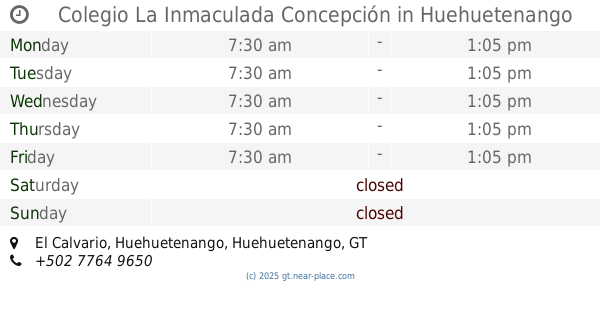
Colegio La Inmaculada Concepción
1 avenida,, El Calvario, Huehuetenango
School
read more
4.711 km
ESCUELA OFICIAL URBANA PARA NIÑAS NO. 1 AMALIA CHAVEZ, JORNADA VESPERTINA, ZONA 1 HUEHUETENANGO
Huehuetenango
School
read more
4.753 km
Iberoamericano
8a Avenida, Huehuetenango
School
read more
4.809 km
Soni.K
Huehuetenango
School
read more
4.867 km
Colegio Evangélico La Aurora
5a Calle, Huehuetenango
School
read more
4.976 km
Dirección Departamental De Educación
Huehuetenango
School
read more
4.995 km
Centro Educativo Tecnológico SION
7a Avenida 6-55, Huehuetenango
School
read more
5.085 km
Escuela Oficial Urbana Mixta Julio César Merida
1 calle, Zona 8, Huehuetenango
School
read more
5.238 km
Liceo Mixto San Jose
Huehuetenango
School
read more
5.347 km
EORM LA UNIDAD
El Mirador, Chiantla
School
read more
5.959 km
salon comunal zaculeu
Huehuetenango
School
read more
📑
all categories
Accounting
Administrative area level 1
Administrative area level 2
Airport
Amusement park
Aquarium
Art gallery
Atm
Bakery
Bank
Bar
Beauty salon
Bicycle store
Book store
Bowling alley
Bus station
Cafe
Campground
Car dealer
Car rental
Car repair
Car wash
Casino
Cemetery
Church
City hall
Clothing store
Colloquial area
Convenience store
Courthouse
Dentist
Department store
Doctor
Electrician
Electronics store
Embassy
Establishment
Finance
Fire station
Florist
Food
Funeral home
Furniture store
Gas station
General contractor
Grocery or supermarket
Gym
Hair care
Hardware store
Health
Hindu Temple
Home goods store
Hospital
Insurance agency
Jewelry store
Laundry
Lawyer
Library
Liquor store
Local government office
Locality
Locksmith
Lodging
Meal delivery
Meal takeaway
Mosque
Movie rental
Movie theater
Moving company
Museum
Natural feature
Neighborhood
Night club
Painter
Park
Parking
Pet store
Pharmacy
Physiotherapist
Place of worship
Plumber
Point of interest
Police
Political
Post office
Premise
Real estate agency
Restaurant
Route
Rv park, camping
School
Shoe store
Shopping mall
Spa
Stadium
Storage
Store
Subway station
Supermarket
Synagogue
Taxi stand
Train station
Transit station
Travel agency
University
Veterinary care
Zoo
administrative area level 3
sublocality level 1
↑