Lodging nearby Autohotel El Dorado
Guatemala
Lodging nearby Autohotel El Dorado
Autohotel El Dorado
Mazatenango Guatemala
contacts phone
:
+502
Latitude:
14.5523165
, Longitude:
-91.5126006
read more
nearest Lodging
324 m
Mazatenango Casa Nazaret
CA-2, Mazatenango
Lodging
read more
480 m
Hotel Pasado De Amor
Mazatenango
Lodging
read more
513 m
Hotel "La Pasion"
Mazatenango
Lodging
read more
1.301 km
Bambu Resort
Km. 159.5 Mazatenango, Mazatenango
Lodging
read more
1.345 km
Residenciales Maria José y El Roble.
Mazatenango
Lodging
read more
1.594 km
Hotel La Cañada
Mazatenango
Lodging
read more
1.899 km
Hotel Gloria
Mazatenango
Lodging
read more
1.952 km
California Inn
Zona 2, Mazatenango
Lodging
read more
2.002 km
Hotel VILLA ISABEL
1a Avenida, Mazatenango
Lodging
read more
2.069 km
Hotel Roma
Mazatenango
Lodging
read more
2.141 km
Hotel Kakol Kiej
Mazatenango
Lodging
read more
2.144 km
Hotel y Restaurante COSTA VERDE
5a. Calle, 4-005, Mazatenango
Lodging
read more
2.159 km
Hotel Costa Rica
Mazatenango
Lodging
read more
2.208 km
Hotel Alba
Mazatenango
Lodging
read more
2.228 km
Hotel San Martin
8a Calle, Mazatenango
Lodging
read more
2.285 km
Hotel Pacific 2
A, 8a Calle, Mazatenango
Lodging
read more
2.287 km
Hotel Pacific
5-88 2 canton santa cristina mazatenango suchitepeques, 8 Calle, Guatemala
Lodging
read more
2.39 km
Arendamientos Doña Claudia
1ra. Av, San Antonio Suchitepéquez
Lodging
read more
2.533 km
Hotel Blanquita
A, 1 Calle, Mazatenango
Lodging
read more
2.667 km
Hotel Rio Dulce
11a Calle, Mazatenango
Lodging
read more
3.444 km
Canton Chita Mazatenango
Mazatenango
Lodging
read more
3.76 km
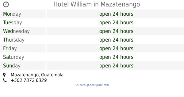
Hotel William
Mazatenango
Lodging
read more
4.192 km
Residenciales Villas De Gaudi
Unnamed Road, San Francisco Zapotitlán
Lodging
read more
4.734 km
El Edén
Mazatenango
Lodging
read more
4.931 km
Hotel Marisha
Guatemala
Lodging
read more
📑
all categories
Accounting
Administrative area level 1
Administrative area level 2
Airport
Amusement park
Aquarium
Art gallery
Atm
Bakery
Bank
Bar
Beauty salon
Bicycle store
Book store
Bowling alley
Bus station
Cafe
Campground
Car dealer
Car rental
Car repair
Car wash
Casino
Cemetery
Church
City hall
Clothing store
Colloquial area
Convenience store
Courthouse
Dentist
Department store
Doctor
Electrician
Electronics store
Embassy
Establishment
Finance
Fire station
Florist
Food
Funeral home
Furniture store
Gas station
General contractor
Grocery or supermarket
Gym
Hair care
Hardware store
Health
Hindu Temple
Home goods store
Hospital
Insurance agency
Jewelry store
Laundry
Lawyer
Library
Liquor store
Local government office
Locality
Locksmith
Lodging
Meal delivery
Meal takeaway
Mosque
Movie rental
Movie theater
Moving company
Museum
Natural feature
Neighborhood
Night club
Painter
Park
Parking
Pet store
Pharmacy
Physiotherapist
Place of worship
Plumber
Point of interest
Police
Political
Post office
Premise
Real estate agency
Restaurant
Route
Rv park, camping
School
Shoe store
Shopping mall
Spa
Stadium
Storage
Store
Subway station
Supermarket
Synagogue
Taxi stand
Train station
Transit station
Travel agency
University
Veterinary care
Zoo
administrative area level 3
sublocality level 1
↑