Food nearby Panaderia el Esfuerzo
Guatemala
Food nearby Panaderia el Esfuerzo
Panaderia el Esfuerzo
Ipala Guatemala
contacts phone
:
+502
Latitude:
14.619685
, Longitude:
-89.6208949
read more
nearest Food
4.929 km
Empresa de Fruta y Hortaliza
Guatemala
Food
read more
19.055 km
Agua Pura La Conquista
Quezaltepeque
Food
read more
19.13 km
Antojitos Chavi
3 av. 3-55 zona 2, RN-18 3-55, Quezaltepeque
Food
read more
21.237 km
Guater Pura
5a Calle, Chiquimula
Food
read more
21.496 km
Rastro Municipal de Chiquimula
Chiquimula
Food
read more
21.692 km
Comedores Mercado Municipal
8a Avenida, Chiquimula
Food
read more
21.731 km
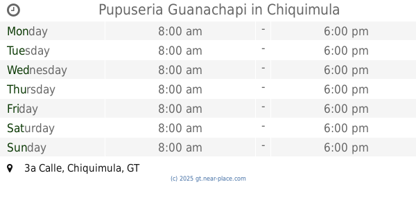
Pupuseria Guanachapi
3a Calle, Chiquimula
Food
read more
21.932 km
Distribuidora La Ceiba, S.A.
15a. Avenida, Chiquimula
Food
read more
22.401 km
Bodega De Don Alejandro
Barrio Sasmó Abajo
Food
read more
22.452 km
Fabrica De Alimentos Y Conservas La Perfecta
Chiquimula
Food
read more
22.77 km
Energuate Shoropin
Calzada Héctor Agusto España Bracamonte, Chiquimula
Food
read more
22.954 km
PIZZA BURGER DINER PRADERA
CA-10, Chiquimula
Food
read more
29.129 km
Fruty Jugos
2-81, 3a. Avenida, Esquipulas
Food
read more
30.192 km
Panaderia Judith
Esquipulas
Food
read more
31.391 km
Agua Pura "Los Pinos"
Colonia San Jose Obrero, Esquipulas
Food
read more
33.243 km
Carnicería Porky
Jocotan
Food
read more
33.654 km
La Bodeguita
Jocotan
Food
read more
38.23 km
Candy paradise
2a Calle, Zona 2, El Progreso
Food
read more
39.924 km
Piñatería Gran Fiesta
4a. Av. 2-25 zona 2 Barrio San Francisco, Jalapa
Food
read more
40.567 km
Pizza Burger Diner Zacapa,Zacapa
Zacapa
Food
read more
42.742 km
Ambev Centroamérica
Teculután
Food
read more
45.149 km
Granja Carrera
Unnamed Road
Food
read more
46.564 km
Distribuidora Areca Y Frisa Jutiapa
Jutiapa
Food
read more
47.069 km
La Postrería
5ta calle, 4, 41, Jutiapa
Food
read more
47.883 km
Dots Metroplaza Jutiapa
Km 116 Carretera Interamericana Aldea Cerro Gordo Zona 0, Jutiapa
Food
read more
📑
all categories
Accounting
Administrative area level 1
Administrative area level 2
Airport
Amusement park
Aquarium
Art gallery
Atm
Bakery
Bank
Bar
Beauty salon
Bicycle store
Book store
Bowling alley
Bus station
Cafe
Campground
Car dealer
Car rental
Car repair
Car wash
Casino
Cemetery
Church
City hall
Clothing store
Colloquial area
Convenience store
Courthouse
Dentist
Department store
Doctor
Electrician
Electronics store
Embassy
Establishment
Finance
Fire station
Florist
Food
Funeral home
Furniture store
Gas station
General contractor
Grocery or supermarket
Gym
Hair care
Hardware store
Health
Hindu Temple
Home goods store
Hospital
Insurance agency
Jewelry store
Laundry
Lawyer
Library
Liquor store
Local government office
Locality
Locksmith
Lodging
Meal delivery
Meal takeaway
Mosque
Movie rental
Movie theater
Moving company
Museum
Natural feature
Neighborhood
Night club
Painter
Park
Parking
Pet store
Pharmacy
Physiotherapist
Place of worship
Plumber
Point of interest
Police
Political
Post office
Premise
Real estate agency
Restaurant
Route
Rv park, camping
School
Shoe store
Shopping mall
Spa
Stadium
Storage
Store
Subway station
Supermarket
Synagogue
Taxi stand
Train station
Transit station
Travel agency
University
Veterinary care
Zoo
administrative area level 3
sublocality level 1
↑